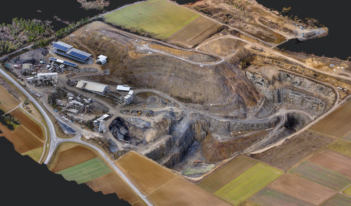
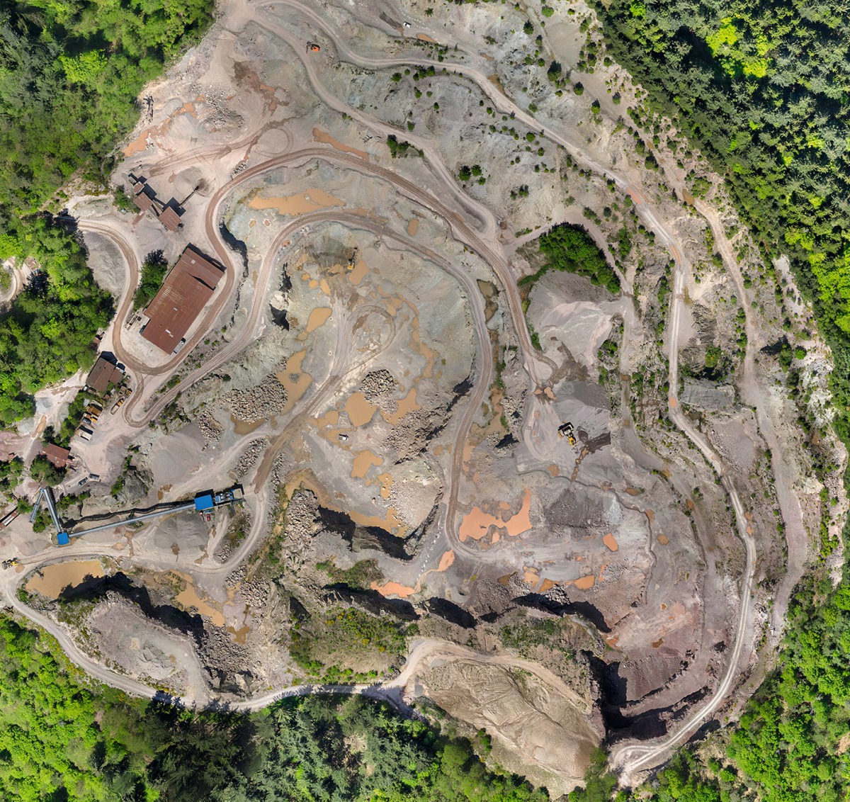
Managing quarries flexibly, fast and cost-efficiently with the help of drones
“Understanding of the specific strengths of drones in a wide range of applications has grown substantially over the past three years and the importance of the systems will continue to grow,“ says Ulrich Strecker, Managing Director of IBS Bauvermessung GmbH, partner of SITECH Deutschland GmbH, quite certain of what he‘s saying. After all, as he explained, drones were becoming more and more sophisticated, easier to operate and the advantages were obvious. They can be used spontaneously, being ready to deploy without the need for any major preparations, large areas can be covered in a short time, neither traffic nor operations on the construction site are obstructed, even built-on or difficult-to-access areas can be imaged easily without any difficulties – and with all this, the deployment of drones was cheap and cost-efficient compared with conventional options.
Drone is only the generic term – there are two types of unmanned aerial vehicles – copters and fixed wing aircraft. In terms of their function and features, copters are similar to helicopters, and thanks to their propeller they can hover in the air like their big brothers, fixed wing aircraft on the other hand are, like aeroplanes, constantly in motion when in action. Accordingly, the Quattrocopter albris sold by SITECH Deutschland GmbH is suitable for use in areas with restricted space for launching and landing, can also perform its duties at very low speed, is extremely agile and can therefore deliver angled images. In addition, it can be controlled manually and is also capable of capturing images overhead.
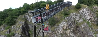
With these flight characteristics, it is the ideal system for flying over small to medium-sized construction sites or quarry faces or for structural inspections of, for example, the undersides of bridges. The Quattrocopter is equipped with a 38 Mpx camera and 6x zoom, it delivers HD images with a resolution of 1 mm from 5 m distance. Moreover, the albris can record videos and deliver thermal images.
The strength of the eBee Plus drone, as a fixed-wing machine, is its ability to cover large areas or flight paths involving large distances. Thanks to the high-power batteries, this drone can fly longer and further. Imaging linear corridors, for example, in road construction or flying over large-area landfills are typical applications. During flight at a flight height of 100 m, the eBee Plus captures an area of just under 2 m² and, being equipped with a high-quality camera, delivers precise images with a resolution of 20 Mpx.
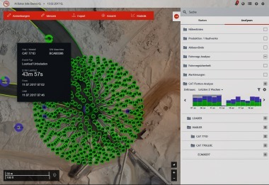
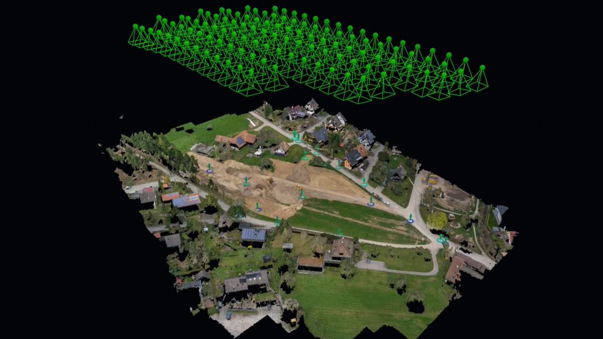
Irrespective of which system the user opts for, when they want an overview from the air, in a first step the exact flight mission must be planned on the computer in the office. “With the help of the appropriate software, the user determines the exact flight paths of the drones,“ explains Strecker, emphasizing the user friendliness of the systems. Then the control points are marked on the ground and measured before the aircraft and the notebook or tablet are connected. Now the user controls the drone per notebook and flies the previously defined mission.
The results of the flights are then imported into the Trimble Business Center – HCE. “This special software is used to calculate a point cloud from the generated images. This step, the so-called photogrammetric evaluation of the images is crucial for the quality of the work,“ says IBS Managing Director Ulrich Strecker. “For an infinite amount of information can be derived from the point cloud,“ continues the expert. Digital models of the terrain, for instance, can be derived for machine control or mass calculations of materials, for example, in future construction pits or material stocks. An excellent working basis are also orthophotos, aerial photos without any distortion that can be read like in a map. These are also suitable for CAD systems and particularly popular for generating measurements.
“Often underestimated at the beginning is the possibility for recording conditions prior to the start of work,“ explains Strecker, this layout can also be used a good basis for further construction site documentation. The high-resolution photo and video images with their enormous depth of detail provide an optimum overview of the entire site. Drone images are also predestined for regular monitoring of construction progress. Drones can play out their strengths in this changing environment.
//www.sitech.de" target="_blank" >www.sitech.de:www.sitech.de